UT Students Win 1st Place in APA Planning and Design Competition

Graduate-level Urban Design and Planning students have placed first in the American Planning Association (APA) Student Planning and Design Competition, hosted as part of the organization’s 2025 National Planning Conference.
Now in its eighth year, the APA Student Planning and Design Competition invites multidisciplinary teams of students pursuing degrees in planning, public policy and administration, urban design, architecture, landscape architecture, and real estate development to create a cutting-edge planning and design proposal for a site within the 2025 National Planning Conference host city.
With this year’s conference hosted in Denver, CO, the 2025 competition focused on the historic Colfax & Federal Clover Leaf, a 46-acre site in Denver with a rich history as one of the original roads to the Rockies. In the aftermath of lost historic buildings caused by an increasingly automobile-centric landscape, this competition prompted students to develop a plan that thoughtfully responds to the legacy of the area while addressing contemporary needs and opportunities.
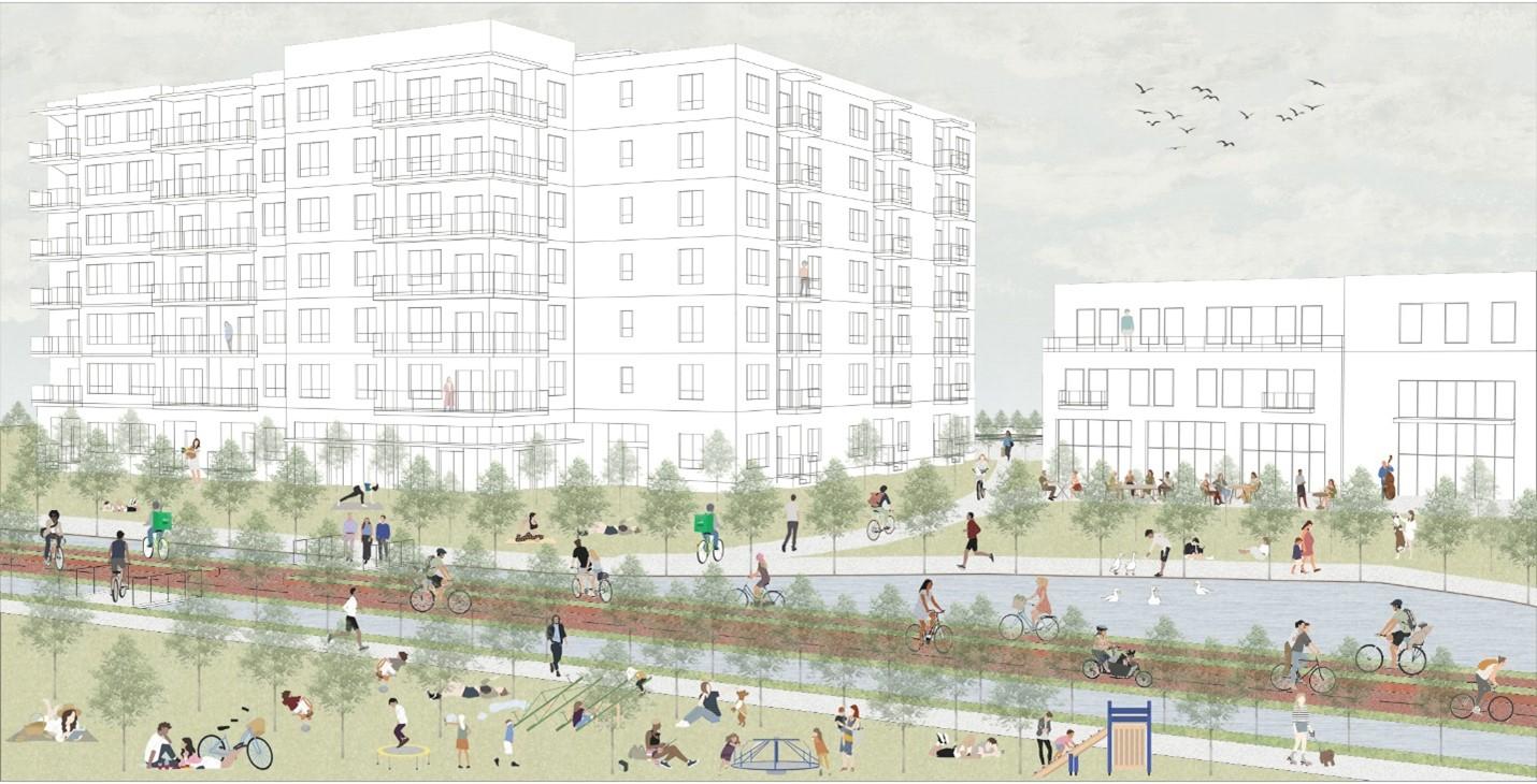
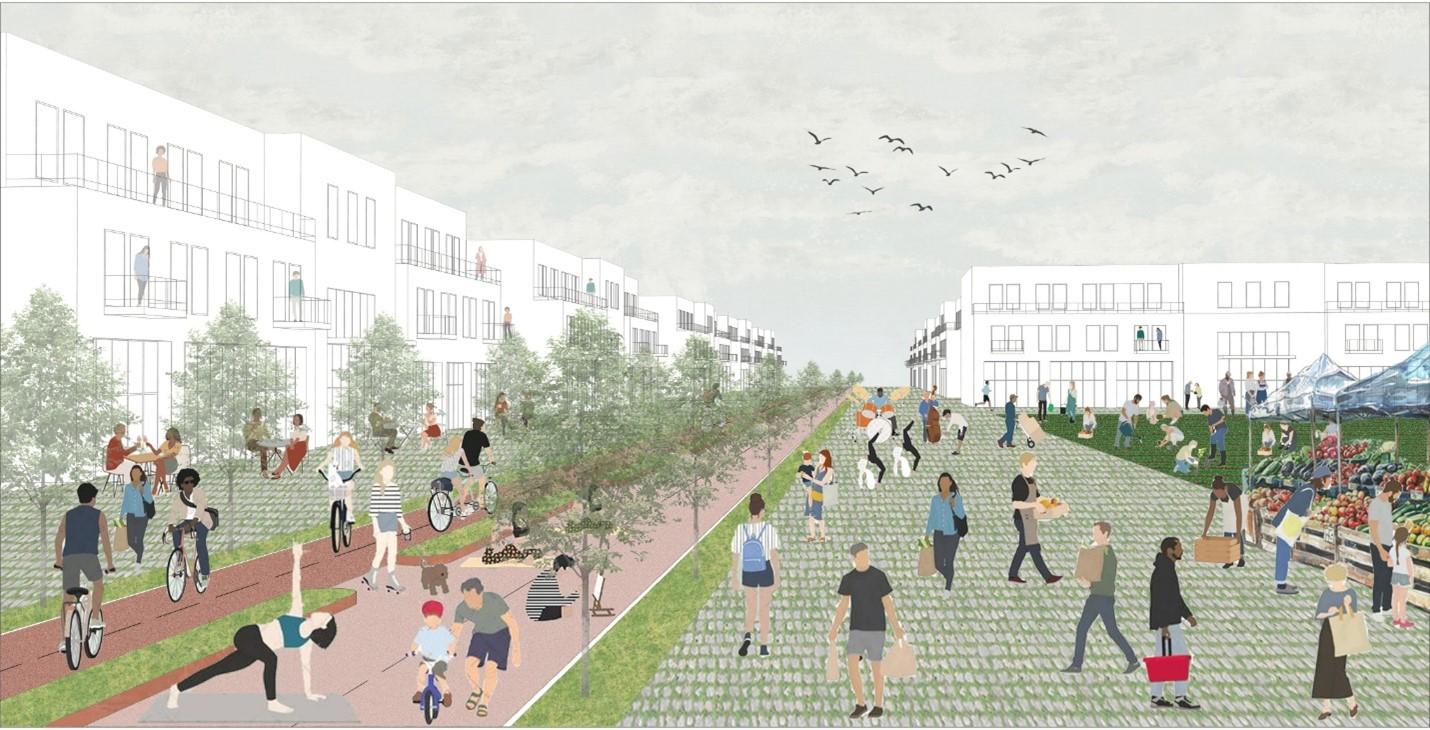
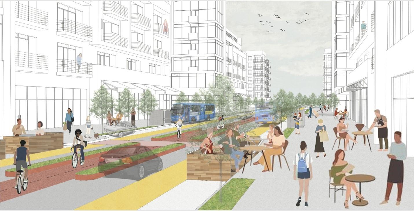
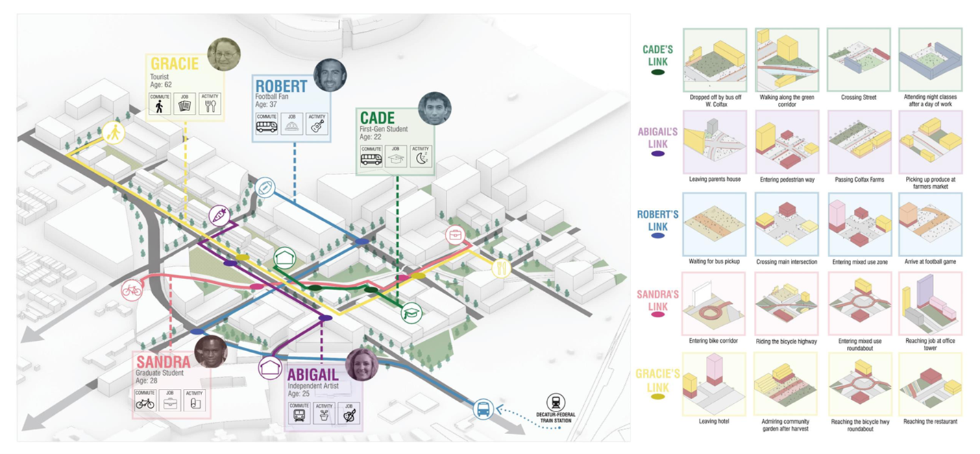
The UT Austin team was comprised of Dual Degree Urban Design and Community Regional Planning students Despina (Tess) Matzakos, Chaochen Fan, Maria Rubio, and Master of Urban Design students Kunth Shah, Edwin Flores. This interdisciplinary team, entitled UDP Collective, developed the winning proposal “Greenlink Denver,” which envisions the area as a comprehensive mixed-use development, serving as a reparative link from what was once an auto-dominant and disconnected site to one of opportunity. Through guiding principles of mobility and connectivity, environmental sustainability, social resilience, and a thriving economy, Greenlink Denver creates a “link” for everyone. The plan prioritizes increased pedestrian, bike, and public transportation mobility, environmental stewardship with year-round outdoor programming, equitable access to housing and social needs, and support for local businesses to promote a thriving economy.
Reflecting on the experience, Despina (Tess) Matzakos notes: “The experience of collaborating on a multi-disciplinary team with diverse backgrounds has been an excellent exercise in merging perspectives on design, policy, and planning. I believe this strengthened our proposal and served as a great learning experience for all of us. Especially at the end of our graduate studies, this project has been a special chance for us to showcase all that we have learned over the past few years and create something we are really proud of."
The students presented their proposal this week at the National Planning Conference in Denver and were one of three finalists, which included groups from the Harvard GSD and the University of Wisconsin-Milwaukee.