Urban Health Risk Mapping

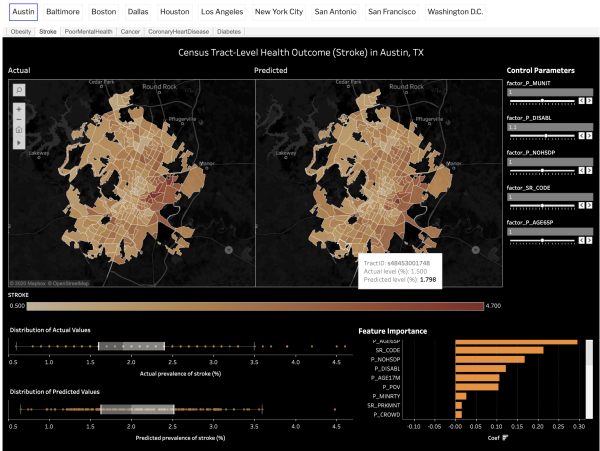
Dr. Feng Chen, Post-Doc Fellow in the Urban Informatics Lab, along with Dr. Junfeng Jiao and an interdisciplinary team of researchers for UT's Good Systems initiative developed an AI system that can measure the health effects of neighborhood environments in Houston, Dallas, San Antonio, and Austin using citizen crowd-sourced data. The research team will map the computed health risk scores at the census tract-level for all selected municipalities and will also build an interactive website that allows users to understand how changes to their neighborhoods can affect their health. For example, if a user changes neighborhood sidewalk density, the website will show the expected changes in health behavior and outcomes, such as decreased physical activity level and increased diabetes risk. The research team will make the health risk map database available to the general public.
The project team used crowdsourcing data and machine learning to predict the census tract-level health outcomes for ten major US cities, including Austin, Baltimore, Boston, Dallas, Washington, D.C., Houston, Los Angeles, New York City, San Antonio, and San Francisco. They looked at health outcomes for obesity, stroke, cancer, coronary heart disease, diabetes, and poor mental health and created an interactive dashboard showing their prevalence.
The project team includes: Valerie Danesh (Nursing), Chen Feng (Architecture), Junfeng Jiao (Principal Investigator–Architecture), Katie Pierce Meyer (Libraries), Weijia Xu (TACC)
