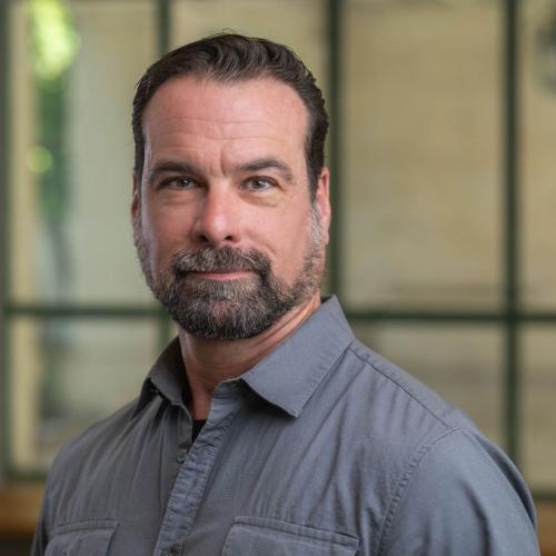
Senior Lecturer


Robert Stepnoski is a Senior Lecturer at the University of Texas at Austin School of Architecture, where he has taught since 2009.
Stepnoski's current research focuses on robotic automation in architectural design and fabrication using KUKA robots. His work integrates industrial robotic systems, and with visual programming platforms such as Rhino3D, Grasshopper, and the KUKA|prc plugin to develop advanced workflows for architectural applications. Stepnoski has authored a growing curriculum of technical lessons and hands-on assignments covering topics including safety protocols, coordinate system setup, KRL (KUKA Robot Language) programming, SmartPAD operation, and parametric motion planning. Emphasizing both physical and digital robotic literacy, his teaching explores applications such as LED light drawing, 2D/3D stippling, pen drawing, foam cutting with hot wire tools, metal dabbing/scoring, and sand carving with custom end effectors. Through an architectural lens, Stepnoski’s courses aim to bridge industrial robotics and design experimentation, training the next generation of architects to use automation in concept development, prototyping, and full-scale fabrication. His pedagogy combines rigorous safety practices with creative exploration, positioning robotics not just as tools of automation but as instruments of spatial and material investigation.
Building on the integration of KUKA industrial robots into architectural design workflows, Stepnoski’s research also extends into the use of unmanned aerial vehicles (UAVs) for mapping, modeling, and site analysis. Where robots like the KUKA KR60s & KR4 R600s enable precise material manipulation and fabrication at close range, drones provide a complementary large-scale spatial capability, capturing environmental and built data from aerial and terrestrial perspectives. Leveraging photogrammetry and LiDAR scanning, UAVs generate high-resolution 3D point clouds that serve as the foundation for digital twins, topographic mapping, and as-built documentation. These datasets can be processed and visualized in Rhino3D, Pix4D and other 3D modeling platforms, forming a feedback loop between scanned reality and robotic intervention. The synergy between robotic fabrication and drone-based site modeling opens new possibilities in automated construction, context-aware design, and adaptive fabrication strategies, aligning digital tools with both material production and spatial understanding.
EDUCATION
- Boston Architectural Center; College of Architecture
- College of Technology at Alfred; State University of New York
PUBLICATIONS + PROJECTS
PUBLICATIONS
Book Chapter: "A Point Cloud Pedagogy", Teaching Architecture(s) in the Post-Covid Era. The New Age of Digital Design. Routledge. 2024. Publication.
Book Chapter: "A Point Cloud Pedagogy", AMPS Book Publication. Kent School of Architecture and Planning. Canterbury, UK. 2023. Publication.
“Scan, Immerse & Experience: VR Enabled Field Study.” Journal of Digital Landscape Architecture. Journal of Digital Landscape Architecture, 7-2022. Wichmann Verlag, VDE VERLAG GMBH · Berlin · Offenbach 2020.
“Digital Landscape Architecture's Extended Reality”. Platform (Fall 2022), "Teaching for Next", School of Architecture, University of Texas at Austin
Paper: "A Point Cloud Pedagogy", Accepted for AMPS Book Publication. Kent School of Architecture and Planning. Canterbury, UK. Spring/Summer 2022. Publication. Video Submission: A Point Cloud Pedagogy
PROJECTS
The Schindler House (1922). “MAK Center for Art and Architecture”. LiDAR Scan. 3D Point Cloud Model. Documentation.
The Gamble House (1908). “Architecture As A Fine Art”. LiDAR Scan. 3D Point Cloud Model. Documentation.
Carl Cheng Exhibition. “Nature Never Loses”. LiDAR Scan. 3D Point Cloud Model. Documentation.
Arthur P. Watson House: LiDAR Scan, VR Model/Walkthrough, UAV Flight, Aerial/Terrestrial Photogrammetry, 3D Point Cloud Model. Documentation.
Zilker Clubhouse: LiDAR Scan, VR Model/Walkthrough, UAV Flight, Aerial/Terrestrial Photogrammetry, 3D Point Cloud Model. Documentation.
Elisabet Ney Museum: LiDAR Scan, VR Model/Walkthrough, UAV Flight, Aerial/Terrestrial Photogrammetry, 3D Point Cloud Model. Documentation.
City of Austin; Combined Transportation, Emergency & Communications Center: LiDAR Scan, 3D Point Cloud Model. Documentation.
VR American A-Frame Exhibition: VR Model & Documentation.
Camp Round Meadow: LiDAR Scan, 3D Point Cloud Model. Documentation.
VR Large City Architecture Research Exhibition: VR Model & Documentation.
French Legation State Historic Site: LiDAR Scan, Aerial & Terrestrial Photogrammetry. Documentation.
LBJ Fountain & Field: LiDAR Scan, Aerial & Terrestrial Photogrammetry. Documentation.
Pennybacker Bridge: UAV Flight. Aerial Photogrammetry. Documentation.
UT East Mall: LiDAR Scan, 3D Point Cloud Model. Documentation.
UTSOA Battle Hall: LiDAR Scan, 3D Point Cloud Model. Documentation.
Coconut Club & Neon Grotto: VR Walkthrough. 3D Point Cloud Model. Documentation.
Oilcan Harry's: VR Walkthrough. 3D Point Cloud Model. Documentation.
Courtyard: Scan, Teach, Immerse. 3D Point Cloud Model, Unity3D Immersive Model.
Living Wall: 3D Point Cloud Model, Interactive VR. Documentation .
2021Antheneum: 3D Point Cloud Model, Interactive VR. Proof of Concept. Documentation.
Architectural Library, Reading Room: 3D Point Cloud Model, Interactive VR. Documentation.
El Paso Studio: 3D Point Cloud Model, Unity3D Immersive Model.